
1. Lac Oubeïra
Geographical Coordinates 36°50'N 8°23'E Area 2,200ha
Location About 50km east of the city of Annaba and 15km west of the border with Tunisia, in the Wilaya
(province) of Et-Tarf, north-easternmost Algeria. A few kilometres west of Lac Oubeïra Ramsar site (see
site account number 2).
Date of Ramsar Designation 4 November 1983.
Other International Designations None.
National Designations Within National Park (Parc national d'El Kala; established by decree 83-462 under
the Law on the Protection of the Environment, law number 83-05).
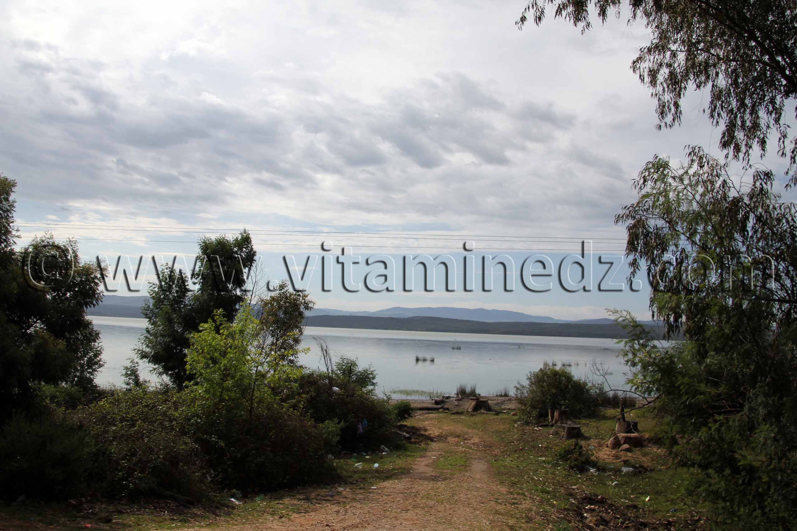
Principal Features The site forms part of the extensive El Kala wetland complex, and includes a shallow
(only a few metres deep), eutrophic, freshwater lake fed by runoff from the wooded hills which surround
the wetland on three sides. The northern, seaward side of the site is formed by a major sand dune system.
Oubeïra is linked with the Mediterranean Sea by the Oued El Kebir, and supports extensive beds of
Potamogeton pectinatus and Trapa natans (rare in Algeria). At times of exceptionally high flow in the
Oued El Kebir, backflow into the lake may occur. The area is of particular importance for wintering water
birds, especially Anas penelope, A. strepera, Aythya ferina, A. fuligula and the globally threatened species
Oxyura leucocephala. Oubeïra supports an abundant fish fauna and may play a major role in the recharge
of regional groundwater. (1a,1c,2a,3b)
Conservation Issues The 1987 Algerian National Report noted that five to six million carp fry had been
introduced to the site in 1985 and 1986. The 1990 National Report referred to the following problems at
Lac Oubeïra: introduction of carp fry; degradation of fringing vegetation; water extraction for irrigation
and domestic consumption; development of neighbouring land for agriculture and grazing; urban
expansion. In the light of this information and consultations with the Algerian authorities, the Ramsar
Monitoring Procedure was implemented at Lac Oubeïra in November 1990. The Monitoring Procedure
Mission which visited the site found that, for the first time in living memory, the lake had dried out
completely in the summer of 1990, owing to a combination of drought and water extraction. Although
desiccation of the lake was a serious matter, it had at least served to kill the introduced carp which were
having an adverse impact on submerged vegetation. The detailed report produced as a result of the
Monitoring Procedure, also included consideration of the impact of the Mexenna Dam being built on the
Oued El Kebir to supply the city of El Kala with drinking water. It was felt that the dam could have a
serious impact on other wetlands in the El Kala region, but that Lac Oubeïra would be relatively
unaffected. The report concludes that ongoing extraction to serve the needs of agriculture was the most
serious long-term threat to the site's ecological character, and recommends that extraction of surface and
groundwater be strictly controlled; conservation and management of the site should be incorporated into a
Regional Plan for wise use and conservation of land and water resources.
-
Votre commentaire
Votre commentaire s'affichera sur cette page après validation par l'administrateur.
Ceci n'est en aucun cas un formulaire à l'adresse du sujet évoqué,
mais juste un espace d'opinion et d'échange d'idées dans le respect.

Posté Le : 12/04/2013
Posté par : patrimoinealgerie
Photographié par : Hichem